Friday, February 27, 2009

MODEL OF HEROD'S TEMPLE


Now, here's a model of biblical proportions. A retired farmer has spent more than 30 years building an enormous scale model of Herod's temple - and it is still not finished.

Alec Garrard, 78, has dedicated a massive 33,000 hours to constructing the ancient temple, which measures a whopping 20ft by 12ft

But Mr Garrard, who started the epic project in his 40s, says his masterpiece will not be finished in his lifetime

"I have also sculpted and painted 4,000 figures, measuring just half an inch and all wearing their correct costumes"

Visitors come from all over the world to see the model and Mr Garrard provides binoculars so they can see all the details

The pensioner has hand-baked and painted every clay brick and tile and even sculpted 4,000 tiny human figures to populate the courtyards

"I personally know all the top archaeologists from Jerusalem and I've had experts from the British Museum visit," he says

He then started to construct the amazing 1:100 scale model, which is now housed in a huge building in his back garden

Wednesday, February 25, 2009

Google Atlantis I


Google Ocean has made an intriguing find. It seems to have found the remnants of a great city on the ocean floor in the location that legend claims Atlantis once thrived. Read about it below and see the photos and a video.


Atlantis?

The Greek philosopher Plato is responsible for modern man having any idea that the great city of Atlantis ever existed at all. Plato’s descriptions of Atlantis have fueled the imagination of men throughout the ages. No evidence of the Lost Continent has ever been found, leaving many to believe it is all just myth. Legend, myth or reality, no one has really known for sure. But books, art, movies and fantasies have continued to keep the myth alive and have blurred the lines between fact and fiction, if those lines were ever there to begin with.

Now modern technology meets ancient mythology through Google Ocean. The search engine giant has extended their program, Google Earth, to allow web users to explore the oceans through thousands of images of underwater landscapes. I’m not quite sure how they have gotten the images. I strongly suspect they don’t have little Volkswagons getting them the way they are getting the images for Google Earth.

Bernie Bamford, 38, of Chester, England found the formation of perfect grids on the ocean floor. The grids are laid out like city blocks and in such a way that it would be difficult to believe they aren’t man made. Its co-ordinates are 31 15′15.53N 24 15′30.53W. What has been found is roughly the size of Wales and it is in the primary location that scientist believe the Lost Continent would have been, near the Canary Islands off the coast of north west Africa.

Last night, Atlantis experts confirmed that the location of the grids are in a place likely to have once been the great city. Archaeologists who have looked at the evidence say that it warrants further investigation. All in all, its intriguing to think that the legend of Atlantis might actually be true and the ruins of the great civilization might be found, by Google no less.

Plato described Atlantis as a highly evolved civilization, very advanced for the time in terms of science, literature and culture. The island was ‘larger than Libya and Asia put together’. According to Plato, the island was disappeared shortly after a failed attempt to conquer Greece. Earthquakes and floods destroyed the island kingdom about 9,000 B.C. So says the legend.

Google Earth, Google Ocean (and Google Mars) are giving us unparalleled access to never before seen places. Its truly fascinating and the possibilities are exciting and fun to imagine.

Unfortunately, Google has debunked the theory that Atlantis has been discovered. Just since I started writing this article, they have come out with a statement explaining away the grid system as trails used by sonar from boats collecting data from the ocean floor.

A spokeswoman said: “It’s true that many amazing discoveries have been made in Google Earth including a pristine forest in Mozambique that is home to previously unknown species and the remains of an Ancient Roman villa.

“In this case, however, what users are seeing is an artefact of the data collection process.

“Bathymetric (or sea floor terrain) data is often collected from boats using sonar to take measurements of the sea floor.

“The lines reflect the path of the boat as it gathers the data.

“The fact that there are blank spots between each of these lines is a sign of how little we really know about the world’s oceans.”

Who knew there were so many boats taking sonar maps of the ocean floor in such a precise pattern! That doesn’t seem logical. Besides, that’s no where near as exciting an explanation as finding Atlantis. Sigh.

LINK

Google Atlantis II - Of course, the UK tabloid The Sun does it up right...

Is this Atlantis?


Map from Atlantis ... spotted on ocean floor


THIS is the amazing image which could show the fabled sunken city of Atlantis.

It shows a perfect rectangle the size of Wales lying on the bed of the Atlantic Ocean nearly 3½ miles down.

A host of criss-crossing lines, looking like a map of a vast metropolis, are enclosed by the boundary.

Graphic

They seem too vast and organised to be caused naturally.

And last night the possibility of an extraordinary discovery had oceanographers and geophysicists captivated.

Hero ... Patrick Duffy in TV show

Hero ... Patrick Duffy in TV show

The site lies 620 miles off the west coast of Africa near the Canary Islands — a location for Atlantis seemingly suggested by the ancient philosopher Plato.

He believed it was an island civilisation sunk by an earthquake and floods around 9,700BC — nearly 12,000 years ago.

The “grid” showed up on Google Ocean, a Google Earth extension that uses a combination of satellite images and marine surveys.

Last night Dr Charles Orser, curator of historical archaeology at New York State University — and one of the world’s leading authorities on Atlantis — called it “fascinating”.

He said: “The site is one of the most prominent places for the proposed location of Atlantis, as described by Plato. Even if it turns out to be geographical, this definitely deserves a closer look.”

The legend of Atlantis has captured the imagination of scholars for centuries.

And in the 1970s it spawned a hit TV series, Man From Atlantis, in which Patrick Duffy played a webbed hero who could live underwater.


Sea here ... location of grid on Google

Situated in an area called the Madeira Abyssal Plane, the grid was spotted by aeronautical engineer Bernie Bamford as he browsed through Google Ocean.


Sunken ... artist's impression of lost metropolis

Bernie, 38, of Chester, said: “It looks like an aerial map of Milton Keynes. It must be man-made.”

Google today claimed the criss-crossing lines were sonar data collected as boats mapped the ocean floor.

But the internet giant said “blank spots” within the lines could not be explained.

A spokeswoman said: “Bathymetric (or sea floor terrain) data is often collected from boats using sonar to take measurements of the sea floor.

“The lines reflect the path of the boat as it gathers the data.

“The fact that there are blank spots between each of these lines is a sign of how little we really know about the world’s oceans.”

Google Atlantis III - And Google has quickly tried to explain the data...

Hopes of finding 'lost city' dashed

Hopes that the lost city of Atlantis had been found on Google Earth have been shattered.

Keen observers had spotted what appeared to be the outline of a vast city - the size of Wales - on the floor of the Atlantic Ocean.

But the criss-crossing lines, located 600 miles west of the Canary Islands, were explained by Google as sonar data collected as boats mapped the ocean floor.

A spokeswoman said: "It's true that many amazing discoveries have been made in Google Earth including a pristine forest in Mozambique that is home to previously unknown species and the remains of an Ancient Roman villa.

"In this case, however, what users are seeing is an artefact of the data collection process.

"Bathymetric (or sea floor terrain) data is often collected from boats using sonar to take measurements of the sea floor.

"The lines reflect the path of the boat as it gathers the data.

"The fact that there are blank spots between each of these lines is a sign of how little we really know about the world's oceans."


Tuesday, February 24, 2009

Hero (62–152 CE)


The Alexandrian inventor, physicist, and mathematician Hero was a creative mind of the second century CE. Hero lived, worked, and taught at Alexandria. Influenced by Aristotle and the atomists, he also built on the work of the mechanical engineer Ctesibius. Hero wrote Pneumatica and Automatapoeica, which described his ideas on physical forces and mechanisms to displace weight, water, and air. He was interested in land measurement, wrote on surveying, and invented a forerunner of the theodolite, a surveyor’s instrument for measuring angles.

Hero was fascinated by actions upon air and water. He argued that air is a material substance that exists within an apparently empty container. He analyzed the displacement of air by pouring water into a jar. He experimented with compression and argued for the presence of vacuums in nature. He was one of the founders of theories of kinetic energy. He explained the action of fire on substances according to the Aristotelian theory that heavy objects fall toward the center while lighter objects ascend toward the heavens. Hero invented a steam mechanism that featured a cauldron of boiling water that released steam through a small tube entering a sphere with two pipes at right angles. As the steam was forced through the pipes the sphere rotated.Another device heated air that filled a container of oil; the oil was forced by the air into tubes held within statues; the oil dripped from the stone hands holding cups for libations. Hero also experimented with pistons, valves, pneumatics, and hydraulics. Most of his inventions were, however, used as toys or for tricks to amuse the rich. For example, Hero contrived a device that, by forcing air through small valves, would produce the appearance and sound of bird’s singing. Another device used principles of heat and air pressure: it was a device made of an iron cauldron filled with water that was heated by a fire. Steam was forced through a small opening at the top of the device, which provided sufficient force to cause a small ball to hang and dance just above the opening.

Hero’s devices were built at a time of slavery when there was no demand for such labor-saving machines. Hero, like most ancient engineers, also turned his skills to military science, working on siege engines, slings, missiles and other ballistics. He also invented an odometer and designed “An Altar Organ blown by the agency of a Wind-mill.”


References

Boardman, John, Jasper Griffin, and Oswyn Murray. Oxford History of the Classical World.

Oxford: Oxford University Press, 1986.

Hero of Alexandria. The Pneumatics.Translated by Bennet Woodcroft. London: C.Whittingham, 1851.

Leicester, Henry M. The Historical Background of Chemistry. New York: Dover Books, 1971.


LINK


Monday, February 23, 2009

The Nampa Image—An Ancient Artifact?


During the drilling of a well in Nampa Idaho in 1889 a tiny figurine made of baked-clay was brought up in amongst the debris churned out by the huge drill bit. The object is a one inch long figure of a man with one leg broken off at the knee, possibly from coming into contact with the drill bit. The possibility of the object being a hoax is extremely doubtful as it was extracted from a depth of about 300 feet making the possibility of someone planting it there highly unlikely. Today the controversial little object remains the property of Charles F Adams and is still displayed in a glass case at Boise’s Park Museum in Boston. Scientists still cannot agree whether the object is a genuine relic or merely a unique little ‘oddity.’


Similar finds have been made in other drilling operations. In 1852 a well driller in Whiteside County Illinois retrieved a copper ring and another copper device shaped like a boat hook from 120 feet below the surface and in 1971 and drill bit brought up a bronze coin from a depth of 114 feet just outside Chillicothe Illinois.


Sunday, February 22, 2009

ANCIENT EGYPT - Antiquarian Map


Abraham Ortelius, in Parergon, Antwerp, 1595
Osher Collection, University of Southern Maine
This map is oriented with east at the top, allowing a detailed rendering of the Nile River and its delta across the width of the map. The inset view of Alexandria at the upper right shows its system of canals and the peninsula of Pharos, site of the great lighthouse, one of the Seven Wonders of the ancient world.

Friday, February 20, 2009

EL DORADO


The existence of a city of gold, or El Dorado, was regarded as fact rather than fiction in Europe during the sixteenth and seventeenth centuries. Men such as Walter Raleigh and Percy Fawcett from England and Cabeza de Vaca, Francisco Pizarro and Francisco Coronado from Spain undertook costly expeditions in the area that is now Mexico and the southwestern states of the USA. All proved futile and costly in terms of lives, money and reputations, yet the failure of one simply spurred on others. Two locations of 'the city of gold' are shown on this map. Each is plotted in an identical manner to all the other places 'known' to exist, such was their 'factual' status. Cibola was believed to be seven golden cities, while Quivira was not only where the gold mines were but also where Montezuma the Aztec King had sent all his gold to be hidden in its underground caves.


Unfortunately, the Spanish translation of the local word cibola as 'gold' was incorrect for its actual meaning was 'buffalo'. There is a parallel, for the buffalo was certainly one of the most valuable things to those living in this part of the world. As for Quivira? Its fabled caves and passages would no doubt have been in the mountain range in whose shadow it stands. Unfortunately, there is no such mountain range.


LINK


Thursday, February 19, 2009

ANCIENT ITALY


Abraham Ortelius, in Parergon, Antwerp, 1595
Osher Collection, University of Southern Maine
This map depicts the entire peninsula of ancient Italy, with a detailed portrayal of topographic features such as coastlines, rivers, lakes and mountains. Political subdivisions are named, and cities are indicated by red symbols in the form of buildings or groups of buildings, the size of the symbol being proportional to the size of the city. A decorative cartouche at the lower center contains imagery from Italian history and mythology.

Wednesday, February 18, 2009

Featured Website: Cryptomundo


We welcome you!

Cryptomundo is a place to enjoy the adventures, treks, theories, and wisdom of some of the most respected leaders in the field of Cryptozoology. This is a place for all ages to share, read, see, and learn about the finds and evidence of the most elusive and rare animals (cryptids) on this planet Earth … Bigfoot, Yeti, Chupacabra, Ivory Billed Woodpecker, Nessie, Yowie, and more. Come back often and be part of the community for Cryptozoology breaking news, new views, fun, and yes occasional humor. We’re glad you’re here and look forward to hearing from you soon.

The Leaders:

Trek the world of cryptozoology with Loren Coleman’s wit and wisdom in his Cryptomundo blog CryptoZoo News.

Journey with Craig Woolheater off the beaten track and along on his hunts to find the hidden in his blog Bigfoot Report.

Take the plunge, and swim along with John Kirk as he explores the watery and land-based worlds of unknown animals in his Cryptid Universe.

Learn from the adventures documented by Rick Noll in his easy to read blog Bigfoot Hunter.

See more engaging, entertaining, authoritative, and educational content here, everyday, on cryptids than any other place on the planet.

Join us now.

If you would like to contact Cryptomundo with a request, an announcement, or just want to send feedback, you can email us using the contact form. We love to hear from our readers, so drop us a line!

Tuesday, February 17, 2009

Shambhala


A hidden holy place in Buddhist mythology, associated with a future Messiah.

The name means “quietude.” Shambhala figures in the Lamaistic Buddhism of Tibet and Mongolia as a venue of spiritual initiation. It is the source or principal source of a system of esoteric lore called Kalachakra, the Wheel of Time, which lays a stress unusual in Buddhism on astronomy and astrology. While Kalachakra is still taught by a surviving Lamaistic school, its reputed place of origin is elusive. Shambhala has been tracked to the north, and the same direction is implied in Tibetan legend. The most detailed account makes it a paradisal valley concealed among mountains, accessible only through a cave or narrow gorge. It may not be “there” in quite the ordinary sense! Lamas connect it with the aurora borealis and say that would-be seekers can only find it if they are summoned by its resident sages. It has a king, who lives in a tower or citadel. One of the royal line received a visit from Buddha himself and wrote down some of his teachings, which were embodied in Kalachakra; this king was an incarnation of Manjushri, the god of divine wisdom.

A Jesuit missionary, Father Stephen Casella, who died in Tibet in 1650, was told about Shambhala. It was known also to Csoma de Körös, a nineteenth-century Hungarian orientalist. Neither, however, discovered where it was. James Hilton may have had it in mind when he invented Shangri-La, but if so, his novel Lost Horizon reflects a theory locating it in the Himalayas, which is a modern fancy incompatible with genuine legend. To the slight extent that real geographic clues have ever emerged, they point toward the Altai range extending from Mongolia into Siberia.

Despite the name’s peaceful connotations, lamas have prophesied a future War of Shambhala in which good forces will conquer evil and bring in a golden age. The messianic figure who will then step forth from the holy place is conceived in different ways. He may be a king of Shambhala called Rigden Jye-po. He may be Gesar, a Mongolian legendary hero. He may be Maitreya, the next Buddha, or a forerunner. There seems to be a remote connection with Hindu beliefs about a future world regeneration by a forthcoming avatar of Vishnu.

During the late nineteenth century, Shambhala began attracting the notice of Western esotericists and inspiring fantastic theories. Madame Blavatsky “HPB,” the founder of Theosophy, mentions it in her writings and spells it with variations such as “Shambalah” and “Shamballah.” She makes one assertion that has left an enduring and misleading mark—that Shambhala is in the Gobi Desert. Long ago, the desert was a vast lake, and Shambhala was an island. It became a haven for a select remnant of “Lemurians” whose homeland sank in the Pacific. It still exists in some sense, though perceptible only to occult vision. Annie Besant, who became Theosophy’s chief leader and ideologue, claimed to have made astral visits to “Shamballa” and had consultations with its ruler, whom she called the King of the World. The king, she explained, was the head of an invisible hierarchy of great beings who met in Shamballa every seven years and guided humanity. In 1913, the king reassured her on the political issue that interested her most: India, he predicted, would become a self-governing member of the British Empire, like Canada or Australia.

Alice Bailey, a latecomer to Theosophy who broke away and started her own esoteric movement, echoes Annie Besant, with elaborations. “Shamballa” was founded by superior beings who came from Venus 18 million years ago. It is built of “etheric physical matter” and, as Theosophists say correctly, is the earthly home of the great spiritual Hierarchy. Bailey gives it several locations, but the Blavatsky-Besant Gobi Desert is the favorite. When the desert was a lake, the island was linked by a bridge with a city of colonists from Atlantis on the south shore. Shamballa is still invisibly present on the site of the island, a sacred city with seven gates ruled by the “Lord of the World.” The Hierarchy confers there in an annual gathering called the Wesak Festival. Buddha is involved in all this, and so is Christ, who is the same person as Maitreya. Alice Bailey predicted his Second Coming before the end of the twentieth century.

Nearly all of this is Theosophical fancy evolved from a few bits of Lamaistic legend. The Gobi location is often referred to as if it were traditional, but it seems to be a product of HPB’s imagination. There is somewhat more authenticity in stories of Shambhala having a sort of downward extension, a subterranean region known as Agharti or Agarttha, the “inaccessible.” This, it seems, has a large population and spreads a long way underground. The ruler of Shambhala rules over Agharti also. Lamas who spoke of him to travelers early in the twentieth century described him as the King of the World—there, perhaps, is the source of the phrase as used by Theosophists. He and his council have telepathic influence over persons in power outside and are secretly manipulating events: this much Annie Besant got right, after a fashion. Rene Guénon, discussing Agharti in Le Roi du Monde, tries to relate it to other sacred centers such as Delphi, but his interpretations are mainly a product of European comparative mythology; at least, their pretensions to being more than that are not very substantial.

The Shambhala-Agharti mythos became influential for a while after World War I and the revolution in Russia. It was picked up by Baron Roman Ungern-Sternberg, a Cossack army leader and anti-Communist fanatic. He journeyed eastward with a notion of organizing a Greater Mongolian state as a bulwark against bolshevism. In 1919, he attached himself to Grigorii Semenov, an adventurer who had seized control of part of Siberia and who welcomed his alliance in the hope of extending his own influence into Mongolia.

Ungern-Sternberg told Mongols that he was a reincarnation of Genghis Khan and would revive their past glories. He also pretended to have an understanding with the King of the World in Agharti. Those who knew him best regarded him as a megalomaniac, almost literally insane. His career was brief—he was killed in 1921 in one of the last flickers of anti-Soviet military action. Yet he had an impact. At Urga in Mongolia, he met Ferdinand Ossendowski, a doctor who had escaped from Siberia. Ossendowski was struck by his ideas and collected lore of Agharti and the King of the World, which he put in a book entitled Beasts, Men and Gods, introducing these topics to the Western public. He included related speculations about an imminent Asian upsurge, heard from the monk in charge of a temple at Narabanchi. According to this monk, the King of the World made a foray from his retreat in 1890 and visited the temple, where he uttered a long prophecy covering “the coming half century”'#8212;actually, much more than that.

As recorded by Ossendowski, the prophecy runs through a succession of horrors more or less fitting World War I, though not closely enough to be impressive. It refers to the Crescent growing dim, a possible allusion to the decline of Turkey; to the fall of kings (as happened in Germany, Austria, and Russia); to roads covered with wandering crowds—refugees, perhaps. But the fairly good predictions are almost swamped by long, vague outpourings about slaughter and earthquakes and fires and depopulation.

After these, the last part of the prophecy is more interesting, not as a forecast but as a just-possible influence in a surprising quarter. Its assessment requires a glance at the context of the early 1920s. Thanks partly to Ungern-Sternberg, the hope of a Shambhalic Messiah grew more specific and even political. The Panchen Lama, at the great monastery of Shigatse, claimed that a predecessor had received a message from the King of the World, written on golden tablets. Expelled in 1923 through a dispute with the more powerful Dalai Lama, he traveled north in the direction of Mongolia, founding colleges allegedly in touch with Shambhala. Mongols began to speak of the War of Shambhala as getting close and to favor the identification of the promised Messiah as Gesar Khan, a hero of their own epic tradition who was destined to return like King Arthur. He would form an Asian alliance against the white races.

Alexandra David-Neel, a student of Lamaism who translated the Gesar epic, saw a shrine with an image of the hero, before which a woman prayed for a son who could fight for him. She was assured several times that he was already in the world and would be manifested in fifteen years. According to her own account, the bard who dictated the epic to her gave her a flower that was a present from Gesar himself—a blue flower of a species that bloomed in July, though it was winter at the time. Another Western inquirer was the distinguished Russian artist and anthropologist Nicholas Roerich, remembered especially as Stravinsky’s collaborator in devising rituals for his ballet The Rite of Spring. Hearing of the ferment in Central Asia, Roerich led an expedition that set off in 1923 and assembled many reports and rumors. He respected some of these as predictive but hoped for a new dawn of enlightenment rather than an outbreak of militancy. As a Shambhalic Messiah he preferred the pacific Maitreya to the martial Gesar.

Communist progress in Mongolia dampened down the excitement. However, Japanese imperialists tried to woo non-Communist Mongols by applying the Shambhala-Agharti mythos to themselves. It has been claimed—though only as part of a dubious “secret history”—that the mythos became a factor in Nazism. The story focuses on Karl Haushofer, a racial mystic who was the principal mentor of Hitler’s deputy Rudolf Hess. During the 1920s, Haushofer allegedly fed information about Shambhala and Agharti to leading Nazis, separating the two places, relocating both in Tibet, and asserting that their occupants possessed occult wisdom and psychic powers that could be used against enemies. On his advice, German expeditions went to Tibet and brought back a large number of Tibetans supposed to have secret knowledge or clairvoyant gifts. Some of them fought in the German army and were found dead in Berlin when the city fell.

Hardly any of this is well attested, though prominent Nazis such as Himmler held bizarre beliefs, and at least one expedition did go to Tibet, but to study Tibetans in the interests of racial pseudo science. Notions about subterranean peoples, derived from fantasy literature, figured in German fringe thinking, but do not seem to have been associated with Agharti. A serious possibility does exist—that Ossendowski’s book, sketching the proposals of Ungern-Sternberg, was seen as offering a hint for disrupting Russia from the rear. If the Hitler elite became aware of it, the last part of the prophecy of the King of the World could certainly have been taken as relevant. Looking ahead from 1890 to the aftermath of World War I, the king speaks of the action he will take by his own mysterious power. “I shall send a people, now unknown, which shall tear out the weeds of madness and vice with a strong hand and will lead those who still remain faithful to the spirit of man in the fight against Evil. They will found a new life on the earth purified by the death of nations.”

Hitler might have seen himself and his movement in this passage. Purification of the earth “by the death of nations” could apply to the extermination of Jews and other condemned breeds: the word genocide was coined to define this aspect of the Führer’s policy when in power. The King concludes: “In the fiftieth year only three great kingdoms will appear, which shall exist happily for seventy-one years. Afterwards there will be eighteen years of war and destruction. Then the peoples of Agharti will come up from their subterranean caves to the surface of the earth.”

This carries the story as far as 2029. Here, it is only the first of the time periods that is interesting. The fiftieth year from the prophetic pronouncement was 1940. In that year, Germany, Italy, and Japan, “three great kingdoms,” formed the Tripartite Alliance that was intended to dominate the world. The subsequent attacks on Russia and the United States were acts of apparent lunacy, yet it could be that delusions about the king’s foreknowledge and guidance of events played a part in the overriding of sanity.

There is a strange sequel. While Communist rule in Mongolia almost broke Buddhism as an organized religion, lamas were allowed to survive as individual scholars. Some of them still expounded Kalachakra and still connected it with Shambhala. In 1970, they acquired an English initiate, Stephen Jenkins, who held a teaching post in their country. He heard a tradition that toward the end of Buddha’s life, a European came to him to learn the wisdom of Shambhala, and this man, the lamas believed, was a Celt. Possibly, he went back, taking what he had learned with him; at any rate, during the last centuries b.c., Shambhala was visibly manifested in Britain. Jenkins wrote that he was “considerably taken aback” to hear this, as well he might be. Can it be given any kind of rational meaning? Some tenuous evidence exists for an Asian influence on the Druids. But it is hard to see what these lamas meant and why their speculations should have fastened on Britain.

Further Reading

Ashe, Geoffrey. Avalonian Quest. London: Methuen, 1982.

———. Dawn behind the Dawn. New York: Henry Holt, 1992.

Ossendowski, Ferdinand. Beasts, Men and Gods. London: Edward Arnold, 1922.

Roerich, Nicholas. Altai-Himalaya. London: Jarrolds, 1930.

Sunday, February 15, 2009

Australian Giant Monitor


AUSTRALIAN GIANT MONITOR seen in 1979 by herpetologist Frank Gordon in the Wattagan Mountains, New South Wales. (William M. Rebsamen/Fortean Picture Library)

Unknown LIZARD of Australia.

Variant names: Burrunjor (in Northern Territory), Mungoon-galli, Murra murri (in the Blue Mountains), Whowie (in Riverina).

Physical description: Length, 20–30 feet or more.

Behavior: Attacks cattle.

Distribution: Northern New South Wales; Arnhem Land, Northern Territory; Cape York, Queensland.

Significant sightings: In 1975, a group of bushwalkers found large tracks and tail marks at the edge of the Wallangambe Wilderness in the Blue Mountains of New South Wales.

On December 27, 1975, a farmer near Cessnock, New South Wales, saw a bulky, 30-foot monitor lizard moving through scrub brush. It was mottled gray in color, with dark stripes along the back and tail, and stood 3 feet off the ground.

In early 1979, herpetologist Frank Gordon was driving his Land Rover in the Wattagan Mountains in New South Wales south of Canberra when he saw a reptile 27–30 feet long by the side of the road. It rose up and ran away on all four legs into the neighboring woods.

In July 1979, cryptozoologist Rex Gilroy was called to a freshly plowed field by a farmer. Across the field were thirty or so tracks that seemed to have been made by an enormous lizard. While most of the tracks had been ruined by rain, Gilroy was able to make a plaster cast of one that had been preserved.

Possible explanations:

(1) The Perentie (Varanus giganteus), Australia’s largest lizard, grows to 8 feet long; some individuals might attain 10 feet. It is cream-colored, with dark-brown speckles, and it occurs from western Queensland to the coast of Western Australia.

(2) Surviving Megalania prisca, a 15- to 21- foot lizard that lived in central Australia in the Pliocene and Pleistocene (2 million–20,000 years ago). At 1,300 pounds, it weighed ten times as much as the Komodo dragon (Varanus komodoensis) and was probably an active predator and scavenger. Its teeth were nearly 1 inch long. At least some specimens had a sagittal crest.

Sources: Rex Gilroy, “Cessnock’s Fantastic 30 Ft. Lizard Monsters,” Strange Phenomena and Psychic Australian, March 1979; Rex Gilroy, “Australia’s Lizard Monsters,” Fortean Times, no. 37 (Spring 1982): 32–33; Rex Gilroy, “Giant Lizards of the Australian Bush,” Australasian Ufologist 4, no. 4 (2000): 17–20.

Saturday, February 14, 2009

ANCIENT TUSCANY


Abraham Ortelius, in Parergon, Antwerp, 1595
Osher Collection, University of Southern Maine
This map depicts the central Italian region of Eturia, later named Tuscany, home of the ancient Etruscans. Believed to have migrated from Asia Minor, the Etruscans were successful traders who built a number of cities, among them Florence, and developed an advanced civilization noted for its art. Etruria was eventually defeated by and annexed to Rome.

Friday, February 13, 2009

BOOK: TRAVELS IN THE NETHERWORLD


Description

In Travels in the Netherworld , Bryan J. Cuevas examines a fascinating but little-known genre of Tibetan narrative literature about the d^'elok , ordinary men and women who claim to have died, traveled through hell, and then returned from the afterlife. These narratives enjoy audiences ranging from the most sophisticated monastic scholars to pious townsfolk, villagers, and nomads. Their accounts emphasize the universal Buddhist principles of impermanence and worldly suffering, the fluctuations of karma, and the feasibility of obtaining a favorable rebirth through virtue and merit. Providing a clear, detailed analysis of four vivid return-from-death tales, including the stories of a Tibetan housewife, a lama, a young noble woman, and a Buddhist monk, Cuevas argues that these narratives express ideas about death and the afterlife that held wide currency among all classes of faithful Buddhists in Tibet.

Relying on a diversity of traditional Tibetan sources, Buddhist canonical scriptures, scholastic textbooks, ritual and meditation manuals, and medical treatises, in addition to the d^'elok works themselves, Cuevas surveys a broad range of popular Tibetan Buddhist ideas about death and dying. He explores beliefs about the vulnerability of the soul and its journey beyond death, karmic retribution and the terrors of hell, the nature of demons and demonic possession, ghosts, and reanimated corpses. Cuevas argues that these extraordinary accounts exhibit flexibility between social and religious categories that are conventionally polarized and concludes that, contrary to the accepted wisdom, such rigid divisions as elite and folk, monastic and lay religion are not sufficiently representative of traditional Tibetan Buddhism on the ground. This study offers innovative perspectives on popular religion in Tibet and fills a gap in an important field of Tibetan literature.

Reviews

"Travels in the Netherworld is well researched, a pleasure to read, and relevant to the interests of students, scholars, and general readers concerned with Tibetan civilization, Buddhist studies, near-death experiences, and the literary depiction of death and post-mortem itineraries. Bryan Cuevas's new book is a noteworthy addition to our knowledge of the rich Tibetan heritage of traditions exploring the life beyond." --Matthew T. Kapstein, The University of Chicago and the Ecole Pratique des Hautes Etudes (Paris)

"The narratives explored in Travels in the Netherworld have been shared by clerics and laity alike for centuries. In this book, Cuevas convincingly demonstrates that stories of death and return were created, told, and retold by women, men, monks, aristocrats, and commoners. Perhaps more than any other form of Buddhist literature, these stories evoke Tibetan concerns about virtue, vice, life, and death in a world defined by uncertainty -- all portrayed through the drama of compelling personal narratives. Cuevas has ensured that the tales of Tibetan revenants will enjoy a long life among contemporary readers, and that such tales must be a central literary source for our ever-evolving appreciation of Buddhism as a living religion. It is sure to revive the study of death in Tibet." --Kurtis R. Schaeffer, author of Dreaming the Great Brahmin: Tibetan Traditions of the Buddhist Poet-Saint Saraha

"Just as the Tibetan spirit mediums described in this book return from the dead and entertain the living with stories of their adventures in the other world, so too the author, Bryan Cuevas, breathes new life into Tibetan concepts of the afterlife. The author's fascinating story casts important new light on a side of Buddhism usually kept in the dark: moral teachings on karmic causation, the daily concerns of common people, the layout of the other world, and the workings of religious narratives. Anyone interested in near-death experience will want to read this lively and provocative book." --Stephen F. Teiser, author of Reinventing the Wheel: Paintings of Rebirth in Medieval Buddhist Temples

Product Details

216 pages; ISBN13: 978-0-19-534116-4ISBN10: 0-19-534116-3

About the Author(s)

Bryan J. Cuevas is Associate Professor of Buddhist and Tibetan Studies in the Department of Religion at Florida State University. He is the author of The Hidden History of the Tibetan Book of the Dead and co-editor of The Buddhist Dead: Practices, Discourses, Representations

Thursday, February 12, 2009

THE BAUCHE MAP OF 1737


The Bauche map (1754) shows the Antarctic continent without ice, divided into two great islands, a fact not re-established until 1958....


Phillip Bauche was a French geographer of the 18th century who also drew a map that clearly shows Antarctica except that Bauche's map shows Antarctica two separate land masses, with detailed shorelines. For many years the map was generally considered to be wrong because when Antarctica was discovered it actually looked nothing what Bauche had drawn. Then in 1958 a seismic survey of Antarctica was carried out which surprisingly showed that Antarctica was indeed two archipelago islands covered by a thick layer of ice that made it appear as only one land mass and not only that, but that the general topography of the lands beneath the ice matches the drawings on the Bauche map in every detail. So how on earth this can be in any way possible? This map means that Bauche was in possession of a correct map showing Antarctica 100 years before it was discovered and not only that, but without any ice on it. Antarctica has not been in an ice free condition for a minimum of at least 10,000 years and many scientists believe that the period of time to be more like several million years.

Tuesday, February 10, 2009

THE ORONTIUS FINAEUS MAP OF 1531


The Orontius Finaeus map was found in 1960 by Charles Hapgood and it too, apparently shows the continent of Antarctica along with the accurate outlines of Antarctic rivers that are now covered by thick glaciers. The map was found in the Library of Congress in Washington DC where it had been sitting unstudied for a great many years. In the map the continent and coastline is shown to be ice free and, like the Piri Reis map, it too shows an accurate depiction of the Ross Sea which today is totally hidden beneath a floating ice shelf several hundred meters thick.


Studies of actual core samples taken from the Antarctic ice shelf have also clearly revealed numerous layers of strata in the ice showing that the area has indeed gone through several periods of dramatic environmental change. Some sedimentary deposits that were found in the samples were from sea water that had flowed into the area and were even actually datable. The tests show that the sediments were deposited sometime around 4000 years ago which indicates that the Ross Sea would have had to have been flowing and free from ice at the time for the deposits to have occurred.


LINK


Sunday, February 8, 2009

Anglo-Saxon Burhs


Alfred the Great effectively saved Anglo-Saxon England from being overwhelmed by the Danes.. Yet Alfred was wise enough to realise that his military successes were only temporary. A more permanent measure of protection was needed against the growing threat of the Danes.

Alfred began a policy encouraging the formation of fortified towns, or burhs, throughout his lands, such that no place in Wessex was more than 20 miles from a town. In exchange for free plots of land within the towns, settlers provided a defense force. The burhs were also encouraged to become centres of commerce and local government. These burhs were located primarily along the coast and the borders of Alfred's lands.

Alfred's son Edward the Elder continued his father's policy of establishing fortified towns, and he and his sister Aethelflaed of Mercia built a new double row of burhs along the old Roman road of Watling Street, which marked the border of the Danelaw as it ran from the Mersey to Essex.

The burhs were remarkable for their time in that they used a regular grid pattern of streets - not unlike the old Roman towns. Indeed, in many cases pre-existing Roman town sites were re-used to create Saxon towns. Why re-use Roman sites? Three main reasons can be found.

First, the Roman towns were sited at key points along the old Roman network of roads. In other words, communication was a key factor in siting Saxon towns. Chester and Gloucester are two examples of towns sited at major road intersections, though they were established by Alfred's successors.

Second, the Roman towns had basic fortifications in place. Walled towns such as Portchester were already defensible. Other Roman towns had earthwork defenses that could easily be repaired and strengthened.

Third, the growth of Christianity influenced the choice of town sites. In areas where the Roman church was strongest (i.e. the south and east), a conscious choice was made to establish sees in metropolitan centres. Contrast this with the Celtic church, which concentrated its efforts on evangelizing in the countryside.

Other Saxon burhs were established on entirely new sites. In this class of burh we find Wallingford, Wareham, and Wilton, among others. Some, such as Lewes, Lyng, and Lydford, were built on promontories of land, with a simple ditch and bank combination adding to the natural defenses.

In cases where Roman towns were reused to create burhs the Saxons did not necessarily follow the Roman street pattern. Although frequently the main street was reused, as at Chichester and Winchester, the Saxons often built their houses upon the firm foundations of the Roman street, with the new streets running alongside.

Of the burhs that have survived as modern towns, little remains to be seen of the Saxon settlements. In some cases the modern streets follow the Saxon street plan, as at Winchester, Cricklade, Chichester, and Wallingford. Remnants of the defensive ditch and bank can be seen at Wallingford, Wareham, Maaldon, Witham, and Cricklade.

THE PERSIAN INVASION FLEETS


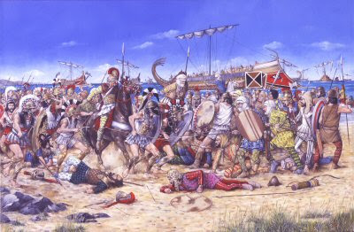
Battle of Marathon by Brian Palmer.


The Battle of Marathon 490 BC during the Persian Greek Wars. King Darious I of Persia sent his son in law Mardonius to invade Greece in 492 BC. The Persian Forces conquered Thrace and Macedonia before their fleet was devastated by a storm. Mardonia was forced to return to Asia. A second Persian invasion force crossed the Aegean sea. After conquering Eretria, the Persian Army under Datis (15,000 strong) landed near Marathon. (Marathon is 24 miles northeast of Athens.) General Miltiades, general in the Greek army gathered a force of 10,000 Athenians and 1,000 Plataean citizen Soldiers.

The ancient world was characterised by a number of epic struggles between mighty civilisations; Egypt vs Nubia, Rome vs Carthage, Greece vs Persia. The last of these had a major impact on the subsequent course of Western history, as the eventual victory of the Greeks allowed them to maintain their independence for another 300 years, during which time Greek culture and science flowered into the period now known as the Golden Age, helping to determine the shape of subsequent Western culture and thought.

Among the key incidents in the history of the conflict between the Persian Empire and the Greek city-states it sought to subdue were the disastrous fates that befell enormous Persian fleets no less than three times. According to ancient sources literally hundreds of ships and thousands of men sank to the bottom of the Aegean, where high rates of deposition of protective silt may well have preserved them for two-and-half millennia, offering a treasure trove of unparalleled archaeological significance to anyone who can locate them.

Darius and Xerxes

In the 5th century BCE the Persian Empire had conquered most of the known world and incorporated lands from the Himalayas to the Balkans, from the Upper Nile to the shores of the Caspian. Under the Persian aegis fell several of the Greek city-states of Asia Minor (modern-day Turkey), while the actions and attitude of the independent states of the Greek mainland irked the Persian emperors. Greek states such as Athens and Eretria had meddled in the affairs of Asia Minor, fomenting rebellions against the Persian overlords, and Darius the Great, emperor of Persia, determined to punish them. In 492 BCE he dispatched an army under his general and son-in-law Mardonius.

The sea monsters of Athos

Mardonius crossed the Hellespont that separated Asia Minor from Europe and marched down the Aegean coast of Greece, accompanied by a mighty fleet to offer naval and logistical support. The fleet sailed across the Aegean to the mainland and followed the coast down to Acanthus. To progress further it needed to detour around the peninsula of Mount Athos, which jutted out into the sea. According to Herodotus, whose Histories are the primary source for the Greco–Persian war, as the fleet ‘made to double Mount Athos’:

A violent North wind sprang up, against which nothing could contend, and handled a large number of the ships with much rudeness, shattering them and driving them aground upon Athos. It is said that the number of the ships destroyed was little short of 300; and the men who perished were more than 20,000. For the sea about Athos abounds in monsters beyond all others; and so a portion were seized and devoured by these animals, while others were dashed violently against the rocks; some, who did not know how to swim, were engulfed; and some died of the cold.

Without naval support Mardonius was forced to turn back and the invasion was postponed for two years. The Persian’s second invasion, in 490 BCE, was no more successful, and before he could plan a third attempt Darius died. It was left to his successor Xerxes to punish the upstart Greek states.

The greatest force the world had ever seen

By 480 BCE Xerxes had gathered what was probably the largest army in human history up to that point. It was said that he wept upon witnessing the serried ranks, overcome by the thought that within a few decades so many men would no longer be alive. The ancient estimates are probably wildly exaggerated – one speaks of the total land and sea forces numbering 2,641,610 men, accompanied by the same number of camp followers and hangers-on, giving more than 5 million people. Modern scholars scoff at these estimates, and it is widely assumed that they are out by a factor of ten. Nonetheless, Xerxes’ army was unprecedented in scale and diversity, comprising warriors from 46 different nations, including many Greek states and colonies that were inimical to the mainland alliance of Athens and Sparta, which led the Greek resistance.

Accompanying the army was a vast fleet, said to number 1,207 triremes (battle galleys propelled by three rows of oars) and countless smaller support, troop transport and cargo vessels. The ships were drawn from Phoenicia, Egypt, Cyprus and Asia Minor, including many of the Greek states under Persian control, and therefore represented a unique cross-section of naval technology and design of the period.

The Magnesian disaster and the Hollows of Euboea

Determined to take no chances with the treacherous waters off Mount Athos, Xerxes had had a canal dug across the isthmus that separated the mountain from the mainland. He had decreed that it should be wide enough to admit two galleys abreast, and the work took two years. Ultimately this extravagant gesture was to little avail – although the fleet successfully negotiated the Athos peninsula, large numbers of ships were lost in two massive storms.

One struck the fleet as it was anchored off the coast of Magnesia in an unfavourable location where there was room for only a few ships in the relative safety of the bay, forcing the others to moor in rows eight deep, which left the outermost ships stuck far out to sea. When a fierce east wind blew up in the morning, only a few of the ships could be dragged up to safety on the beach. According to Herodotus, the ships caught in the open sea were exposed to the gale and dashed against the rocks and coast at Pelion, Cape Sepias,Meliboea and Casthanaea.

The Greeks put this stroke of good fortune (from their point of view) down to the intercession of Boreas, god of the north wind. Divine providence or not, the disaster cost the Persians both ships and loot. Herodotus tells us:

The most conservative estimate of how many ships were lost in this disaster is 400, along with innumerable personnel, and so much valuable property that a Magnesian called Ameinocles the son of Cretines, who owned land near Sepias, profited immensely from this naval catastrophe. In the following days and months gold and silver cups were washed ashore in large numbers for him to pick up; he also found Persian treasure-chests, and in general became immensely wealthy.

While the main body of the fleet was suffering off the Magnesian coast, a detached squadron of 200 ships was attempting to round Euboea to outflank the Greek fleet. They too suffered from the storm. According to Herodotus the high winds smashed the ships against the shoreline known as the ‘Hollows of Euboea’, and all 200 of the galleys were lost.

In practice neither of these disasters made too much of a dent in the Persian fleet, vast as it was, but they helped to prevent it from gaining a tactical advantage over the outnumbered Greek navy, which got the better of subsequent naval engagements, including a battle in the Artemision Channel in which many Persian galleys were destroyed. These naval victories halted the Persian advance and effectively ended Xerxes’ hopes of a swift and crushing victory in the war as a whole. Without naval support, Xerxes felt compelled to pull the bulk of his forces out of the Balkans, leaving Mardonius to pursue the war, which proved beyond him. Eventually the Persians were forced out of Greece forever.

Aegean treasure

Even if Herodotus was exaggerating the numbers of galleys and men involved and the numbers lost during the Persian invasions, the potential value of the wrecked fleets could be huge. There could be the remains of hundreds of ships, thousands of men and huge quantities of weapons, armour, stores and supplies and loot of all types resting at the bottom of the Aegean. All of it dates back 2,500 years to a period about which there is scant archaeological evidence, at least for ships and naval technology. The size and diversity of the Persian invasion forces mean that the remains would offer a unique picture of peoples and military and naval technology, not just from Persia and Greece but from across the ancient world. For the acquisitive there is also the promise of large quantities of precious objects and precious metals, like the ‘gold and silver cups … and Persian treasure chests’ mentioned by Herodotus.

The ultimate prize for archaeologists, however, would be the discovery of the wreck of a trireme, the large galleys that constituted ships of the line for ancient navies. No trireme has ever been found, and historians are still in the dark about many aspects of this potent ancient naval technology. When a replica trireme was constructed, for instance, it was found that it could not match the performance capabilities ascribed to ancient galleys, which were much faster than modern experts are able to explain. Finding one of 1,000+ plus sunken galleys of the Persian invasion fleets could help to resolve decades of academic disputes. According to Dr Robert Hohlfelder, a maritime archaeologist at the University of Colorado, Boulder: ‘Underwater archaeologists have wish lists. A trireme is certainly one of the top ones on most people’s lists. And I think this [the waters off Mount Athos] is one of the best places to look for them.’

However, there are reasons why trireme remains have proved so elusive. Since ancient galleys did not use ballast, they did not sink when wrecked but floated on the surface. Ancient sources record how they were salvaged simply by being towed back to land, where they were either repaired or recycled for other purposes. Cargo would sometimes act as ballast, dragging a ship to the bottom, which is why ancient cargo ships have been recovered, but triremes were war galleys and hence did not carry heavy cargoes in their hold. The heaviest part of the trireme was probably the bronze ram on the prow that was used to smash enemy ships, and these may be lying on the bottom of the Aegean awaiting recovery, along with metal arms and armour carried by those on board.

Preserved in the deep

The Mediterranean is one of the most intensively exploited seas in the world, and has been so for millennia. This applies to treasure hunting and looting of wrecks, and there is considerable concern that many of the best/most accessible ancient wrecks have already been stripped of anything valuable, damaging and rendering them useless for archaeology in the process. Similarly, the prevalence of dragnet trawling, where fishermen drag heavily weighted booms with attached nets along the bottom of the sea, destroying everything in their path, has probably damaged or obliterated many ancient wrecks.

But the experts hope that the context of the Persian fleet wrecks may have preserved them from the looters. The fleets came to grief in deep water, especially the biggest potential wreck focus, off Mount Athos, where the sea bottom drops sharply to depths of 600 metres (2,000 feet) or more. This area is also quite remote, which should have helped to protect it from looters. An additional benefit is that silt is deposited quite fast in the Aegean, so that any remains may have been rapidly covered in a layer of preserving and protective silt.

Looking for the Persian fleets

In recent years the story of the Persian fleets has gained a new profile thanks to a concerted international effort to locate and study the wrecks, an effort made possible by new technology. The Persian Wars Shipwreck Survey (PWSS) – a joint programme by the Greek Ephorate of Underwater Antiquities, the Hellenic Centre for Marine Research and the Canadian Archaeological Institute at Athens, together with various other academics and institutions – uses side-scan sonar, mini-submarines and submarine remote-operated vehicles (ROVs) to map and explore the locations described by Herodotus.

In its three seasons of exploration so far the PWSS has explored the waters off the Mount Athos peninsula, the Hollows of Euboea (off the coast of southern Euboea) and the Artemision Channel, site of a major naval battle. The results have not been breathtaking. So far one of the main discoveries has been the location of the wreck of a cargo ship off Mount Athos, which was carrying amphorae identified as being from Mende, a Greek city to the west of Mount Athos. This could mean that the ship had nothing to do with Darius’ fleet (it could date from up to a century earlier), or it could have been a supply ship carrying material requisitioned by the Persian invaders.

The headline discovery, however, has been attributed to the help of an octopus, likened to one of Herodotus’ ‘monsters beyond all others’. Alerted to the fact that local fishermen hauling in their catch had chanced upon two bronze helmets from the classical period (500–323 BCE), the PWSS crew searched in the same area and spotted a large jar on the seabed. The jar was home to an octopus, a creature renowned for occasionally retrieving sunken objects and squirreling them away in its lair. Sure enough, the octopoid loot proved to include a bronze sauroter – a pointed spear butt or butt-spike that fitted onto the end of a Greek hoplite’s (infantryman) spear, allowing it to be stuck into the ground and also making it a double-ended weapon. Finding the weapon accessory where two pieces of armour have also been recovered has strengthened belief that the wrecks of the Persian fleet (which included many Greek soldiers from the vassal states in Asia Minor, as well as from Greek states inimical to Athens and Sparta) do lie in the area.

The PWSS team has had less luck in the waters around Euboea, but it plans to return in 2006 to continue mapping the sea floor and looking for promising targets to investigate using its submersibles. It also warns, however, that academics are not the only ones equipped with such technology. Katerina Dellaporta, director of underwater antiquities for Greece and one of the survey’s leaders, has warned, ‘Before, looters would only do scuba diving. But now, the technology [such as ROVs] allows everybody to have access to deeper waters.’ While the assertion that ‘everybody’ might get access to deep water is perhaps an overstatement (buying and operating an ROV costs tens–hundreds of thousands), it is to be hoped that archaeologists and not looters are the first to locate the lost wrecks of the great fleets of Darius and Xerxes.


LINK

Saturday, February 7, 2009

THE CONQUESTS OF ALEXANDER THE GREAT


Abraham Ortelius, in Parergon, Antwerp, 1595
Osher Collection, University of Southern Maine
This map depicts the vast area conquered by the young Macedonian king Alexander the Great, extending eastwards from Byzantium and Egypt to the Indus River. An inset in the lower left corner presents a finely engraved bird's-eye view of the oracle of Zeus at Ammon, Egypt. Surmounting the dedication cartouche at the lower right is an engraving of a gold coin bearing the helmuted likeness of Alexander.

Friday, February 6, 2009

AFTER AKHENATON


Akhenaton’s rule had not been the idyll that was conjured up in art. Reality lay in the hunger, suffering, and death beyond the borders of Aton’s Horizon. In the eyes of all but the elite around him, pharaoh had wrecked society. As troops made up of foreign soldiers policed the land prohibiting the worship of every god but Aton, the Egyptian empire was being shaken to its foundations. The uneasy feeling that his revolution had failed probably plagued the last years of pharaoh’s life. He died in year seventeen. By then Kiya had disappeared, as had Nefertiti.

Following pharaoh’s death, Aton’s Horizon was abandoned and avoided as a place of unspeakable heresy. The last of the inhabitants fled hastily and never looked behind them. Eating and drinking vessels were left on tables, children’s playthings lay abandoned in the empty halls. Desert winds tore open the shutters, sand drifted over the floors, fish pools dried up, and fruit trees withered. The whole city decayed into ruins. It perished as rapidly as pharaoh had brought it to life.

Smenkara had passed away after a brief reign. The boy Tutankhaton was taken to Thebes and his name changed to Tutankhamun. Deep scars and a sense of shaken confidence pervaded Egypt. Superficially, the country returned to the traditional religion that had prevailed before Akhenaton, but in reality nothing could ever be the same again. On the good side, the new freedom in art lived on. In writing, the use of the vernacular had spread. It led to the development of new literary styles in the Ramesside Period. However, a dark, brooding mood hung in the air.

Unlike the other boy-kings of the Eighteenth Dynasty for whom their mothers acted as regents, Tutankhamun (1336–1327 bc) had no elder queen to look after him. The courtier Ay was appointed to act in his name as God’s Father. Ay’s policy was one of thorough and non-violent restoration. The young king was married to his half-sister Ankesenpa-aton, renamed Ankhesenamun. The residence was moved to Memphis, but Thebes remained a religious center, “the southern Heliopolis,” to satisfy the High Priest of Amun. It remained the burial ground for kings until the end of the New Kingdom.

General Horemhab continued to command the army. Maya, the “overseer of the king’s treasury,” was sent on a mission to demolish the temples and palaces of the former regime. Maya probably organized the transfer of the mortal remains of the royal family from Aton’s Horizon to Thebes. From Memphis, Tutankhamun issued the Restoration Decree that reinstated all the traditional cults.

The people could now return to their faith. A major campaign to rebuild the temples and reorganize the clerical administration was set in motion. The army resumed its forays to Syria, encountering the Hittites, the new military power from Anatolia. These skirmishes had failed to establish a new balance of power. On the other hand, reasserting Egyptian authority in Nubia was more successful. With Horemhab, Egypt was back in the military arena.

The events surrounding the death of young Tutankhamun are far from clear. The king died unexpectedly in his tenth regnal year. The same year Horemhab led a military expedition against the Hittites at Amqa in Syria that ended in Egyptian defeat. By the time news of this disaster reached Egypt, Tutankhamun was dead. The funeral was conducted by the aged Ay, who also assumed the throne (1327–1323 bc). He had appropriated the royal tomb for himself, hastily burying Tutankhamun in a small, makeshift grave that could barely contain the quantities of goods customary to a king. Sheer chance preserved this improvised burial for posterity.

Since Ay had no male heir, he designated general Horemhab as his successor. It may have been at this point that the widowed Ankhesenamun, Akhenaton’s daughter, took the bold step of writing to the Hittite king, prompted by fear, as she said in her letter. She asked him to make one of his sons her husband in order that “Egypt and Hatti become one country.” This extraordinary step met with suspicion in the Hittite capital and the king hesitated. In the end, he decided to dispatch his son Zananza to Egypt, but the unfortunate prince was murdered on the way. The result was prolonged warfare with the Hittites.

Who was Ankhesenamun afraid of? A fragmentary cuneiform letter from Ay suggests that he tried to make amends with the Hittites, denying all responsibility for the death of the prince. Backtracking on his earlier decision, he also made an effort to prevent Horemhab from becoming king after his own death, appointing the army commander Nakhtmin (possibly a grandson) as heir. Shortly thereafter, he died. Despite Ay’s efforts, Horemhab succeeded in mounting the Egyptian throne and despoiling the tombs of both Ay and Nakhmin. Ankhesenamun and her sisters were heard of no more. Though riddled with difficulties, the general’s path to the throne could not be stopped. In his salient Coronation Stele, Horemhab claimed kingship through the divine oracle of Horus of Hutnesu (probably his birthplace) in the tradition of the Thutmoside kings.

By comparison to his dramatic rise to the throne, Horemhab’s reign (1323– 1295 bc) appears uneventful. Even its exact length is not clear; in inscriptions, he counted his predecessor’s rule as his own. His highest attested regnal year in Egypt is thirteen; Babylonian chronology, as well as two posthumous texts, indicated that he ruled longer.

Horemhab had been married to Mutnedjmet, whose only known title was the ordinary “songstress of Amun,” but the couple had no children. As heir he chose Paramessu, the commander of the fortress at Sile on the land bridge to Syria, possibly preoccupied with reorganizing the army in the north.

Paramessu’s family came from Avaris, the former capital of the Hyksos. When Horemhab died, Paramessu became king Ramses I (1295–1294 bc). The throne of Egypt was firmly in the hands of the army. With the end of the Eighteenth Dynasty history had come full circle. Avaris rose up from the ashes while Thebes was never to be the capital of Egypt again. The divine ancestor of the Ramesside kings was Seth. Avaris became the new residence of the Ramesside rulers.

Ramses I was probably old when he was made king, with a son and grandson already born to him. His reign lasted for barely a year, during which his son Sety was appointed commander of Sile, vizier and High Priest of Seth. In a few months, he was king (1294–1279 bc).

If Ay can be called the architect of the restoration, Sety was undoubtedly its master builder. His entire reign epitomized a commitment to the recovery of the faith lost in the censorship and iconoclasm of Akhenaton. Everywhere, inscriptions and images hacked out by Akhenaton’s agents were re-carved. At Thebes, the festival of Amun, the Beautiful Feast of the Valley, was reinstated. At Abydos, a magnificent new temple complex recreated the mythical burial of Osiris. Sety’s dedicatory inscription listed all the former kings of Egypt; the list had Horemhab directly succeeding Amenhotep III. Akhenaton, Ay, and Tutankhamun were left out.

Most impressive of all were Sety’s attempts to resolve the crisis in religious thinking that was a direct result of Akhenaton’s monotheism. Steeped as we are in centuries of monotheistic thinking we might easily underrate the theological achievement of Akhenaton. He was a true reformer. He has been called “the first individual in history.” His single creed introduced a semblance of order into an otherwise chaotic religious legacy. His historical importance is incontestable; centuries later, his thought and poetry would continue to inspire religions that were to follow.

The polytheistic religion of Egypt had come from many different sources. There were several creator-gods and creation myths. Temple establishments had maintained their independence, taken care of their own traditions, and looked after their own interests. Depending on the political climate, their influence rose and fell. Religious life relied on ritual and cult rather than on ordered religious thought. Faith was often manipulated to suit the purpose of the rulers, superstition and magic reigned unfettered, and priests had the sole authority to define truths. Tombs were granted only to those who were obedient to the king and papyri sold to the credulous like papal indulgences to exonerate them in the next world. In the midst of this, Akhenaton had raised the question of the One True and Living God. He had obliterated the social and religious hierarchy, at least in theory, and placed all people in humility before the sole creator. In fact, it had become impossible to relapse into the old familiar beliefs without attempting a religious reformation.

Sety tried to reconcile the contradictions that now glared at everyone. He encouraged theologians to probe more deeply into ancient dogmas and unite them into a single, respectable system of beliefs. The results of this rethinking were evident both in the temple complex at Abydos and in Sety’s tomb in the Valley of the Kings. The former made the attempt to transform the religion of Osiris into a universal creed. The latter contained the most complete rendition of all the existing Books of the Afterlife. Their layout within the tomb reflected the attempt to treat them as a distinct body of religious texts. These two monuments presented new religious ideas that united the old with the new, the One with the Many. Sety’s monuments became blueprints. The theological reconciliation offered by the religious thinkers of his time was scrupulously followed until the end of the New Kingdom.

It was possibly from Akhenaton’s verse – “you are one, yet a million lives are in you” – that the Ramesside designation of a new all-god, “the one who made himself into millions,” was coined. This formula was probably the precursor of the Hermetic hen kai pan, the concept of god as one and all, developed in Greco-Roman Egypt. Akhenaton’s ideas lived on. Through Hermetic philosophy they eventually influenced much of early Christian thought.