Russian winter landscape. A church. A snowstorm.
Narrator. Hello
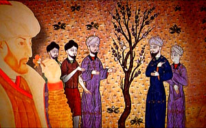
. In 1453, the Byzantine Empire fell. Let us now take a look at how this happened.
Islamic chant weaves into the gusts of freezing wind.
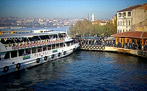
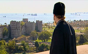
Istanbul. The muezzin continues his prayer, amplified by a loudspeaker. The noise of a market place in a Middle Eastern city. Turkish conversation.
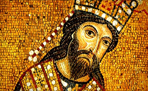
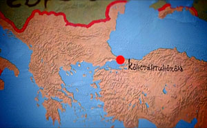
Narrator. This city was once called Constantinople; six centuries ago it was the capital city of what was without exaggeration one of the greatest civilizations in world history—the Byzantine Empire.
 |
|
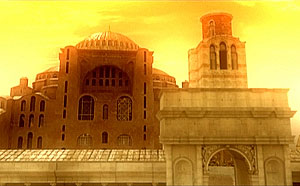
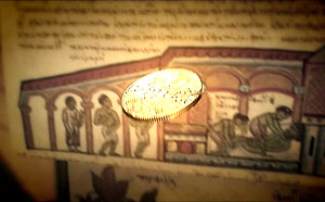
A rule by law, something we now take for granted, was created here, based upon the Roman codes, in Byzantium, 1500 years ago. A legal system which was to become the basic foundation of all types of laws in most modern governments was the monumental creation of Byzantine jurisprudence during the reign of Emperor Justinian. The system of elementary and higher education first developed in Byzantium; it was here, in the fifth century, that the first university appeared. The most stable financial system in the history of mankind was created in Byzantium, and existed in a nearly unaltered form for over one thousand years. Modern diplomacy with its basic principles, rules of conduct, and etiquette was created and refined here, in Byzantium. Byzantine engineering and architectural arts were unrivalled. Even today, such famous works by Byzantine masters as the domes of the Hagia Sophia amaze the world with their technological perfection. No other empire in human history lasted as long as Byzantium. It existed for 1123 years. In comparison: the great Roman Empire collapsed 800 after its establishment; the Ottoman Empire fell apart after 500 years; the Chinese Qing (or Manchu) Empire, after 300 years. The Russian Empire lasted 200; the British, 150; the Austro-Hungarian empire lasted around 100 years. During its height, Byzantium was home to one sixth of the entire world population. The Empire stretched from Gibraltar to the Euphrates and Arabia. It encompassed the territories of modern Greece and Turkey, Israel and Egypt, Bulgaria, Serbia and Albania, Tunis, Algiers and Morocco, part of Italy, Spain, and Portugal. There were around one thousand cities in Byzantium—nearly as many as in modern Russia.
 |
|
The capital city’s incalculable wealth, its beauty and elegance, amazed all the European peoples, who were still barbarians at the time when the Byzantine Empire was in its apogee. One can only imagine—indeed, history records it as such—how crude, ignorant Scandinavians, Germans, Franks, and Anglo-Saxons, whose chief occupation at the time was primitive sacking and pillage, after arriving from some town like Paris or London (which had populations of some tens of thousands) to this megalopolis of millions, a city of enlightened citizens, scholars, and elegantly dressed youths crowding imperial universities, dreamt of only one thing: invading and robbing, robbing and invading. In fact, when this was actually accomplished in 1204 by an army of Europeans calling themselves Crusaders, who, instead of freeing the Holy Land treacherously sacked the most beautiful city in the world, , Byzantine treasures were carried away in an uninterrupted flow over the course of fifty years. Hundreds of tons of precious coin alone were carried away at a time when the annual budget of the wealthiest European countries was no more than two tons of gold.
 |
|
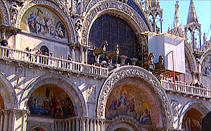
Venice. The Cathedral of St. Mark. All the columns, marble, and precious adornments were stolen at that very time. By the way, those horses are from the imperial quadriga, carried away from Constantinople by the Crusaders. Priceless holy relics and works of art were looted, but even more taken by barbarians from Brussels, London, Nuremburg, and Paris were simply destroyed—melted down into coin or thrown away like refuse. To this day, the museums of Europe are bursting with stolen Byzantine treasures. But let us take into consideration that only a small portion was actually preserved.
It was during this period of looting that the monstrous modern lending system was created using treasures stolen from Constantinople. This average sized city in Italy—Venice—was the New York of the thirteenth century. The financial fate of nations was decided here. At first most of the booty was easily taken by sea to Venice and Lombardy (the Russian word for “pawn shop” to this day is “Lombard”). The first European banks began to spring up like mushrooms after a good rain. The English and Dutch, more reserved than their contemporary Italians and Germans, joined the activity a little later, and, with the help of Byzantine riches pouring in, developed that famous capitalism with its inevitable lust for profits, which is essentially a sort of genetic continuation of the sport of military plunder. The first significant Jewish capital was a result of speculation in Byzantine relics.
An unprecedented flow of free money caused the Western European cities to grow wildly, and became the decisive catalyst in the development of craft, science, and the arts. The barbaric West became the civilized West only after it had taken over, stolen, destroyed, and swallowed up the Byzantine Empire.
We must admit that our own Slavic forebears were no more well-mannered, and also succumbed to the barbaric temptation to get rich quick at the expense of Constantinople’s seemingly inexhaustible wealth. However, to their credit, and fortunately for us, their lust for the spoils of war did not eclipse the most important thing: Russians comprehended Byzantium’s greatest treasure! This was neither gold, nor expensive textiles, nor even art and sciences. The greatest treasure of Byzantium was God.
Having traveled the world over in search of the truth and God, Prince Vladimir’s ambassadors experienced only in Byzantium that a true relationship between God and man exists; that it is possible for us to have living contact with another world. “We did not know whether we were in heaven or on earth,” said the ancestors of present-day Russians, astounded by their experience of Divine Liturgy in the Empire’s most important cathedral, the Hagia Sophia. They understood just
what kind of treasure can be obtained in Byzantium. It was upon this treasure that our great forebears founded not banks, nor capital, nor even museums and pawn shops. They founded Rus’, Russia, the spiritual successor of Byzantium.
 |
|
So what made it possible for a nation so great in the arena of world history, with such extraordinary capabilities, to so suddenly begin to lose its life force? What is most interesting is that the problems Byzantium met during its period of decline—aggression from foreign nations, natural disasters, economic and political crises—were nothing new for this over a thousand-year-old government with its proven mechanism for getting out of the most difficult situations. After all, the empire had experienced all these things before, and had overcome them. Yes, there were many envious enemies both east and west, there were earthquakes, there were plagues; but it was not these which crushed Byzantium. All of these problems could have been overcome if only the Byzantines had been able to overcome themselves.
Today we will talk about that inner enemy which appeared within the spiritual bowels of Byzantine society, and broke the spirit of that great nation, turning it into a helpless victim of those historical calls—calls which Byzantium was no longer able to answer.
 |
|
Nowadays we generally assess a society’s well-being according to its economy. Although the word “economics,” and even the science of economics itself hales from Byzantium, the Byzantines themselves never gave it much attention. The Byzantine financial-economic system underwent several serious crises during the course of history, but the effectiveness of the Empire’s industry and agriculture generally enabled it to weather the storms. It suffices to say that for a thousand years, all international trade was based upon the Byzantine gold coin. But Byzantium could not solve the problem of its government’s loss of control over its own finances and the huge, ungovernable process of capital flow towards the West, to developing Europe, and this is what finally destroyed its economy. The government dropped all levers of trade and industry, and in the end gave all its trade and industrial resources over to foreign entrepreneurs.
It happened like this: An important financial resource in the country was not gas and oil, as it is now, but customs obtained from the enormous international trade in the Bosphorus and Dardenelles. The Byzantines, who earlier relied solely upon their own capability to govern the country’s economics, suddenly began heated discussions about, and finally decided upon, consigning the problems of international trade to their foreign friends, who were more resourceful, and ready to take responsibility for the expense of complex transport, armed guards along trade routes, the construction of new ports, and the intensification and development of commercial activities. Western specialists were called in from Venice and Genoa, towns which had grown large on several centuries of Byzantine trade. They were granted duty-free trade, and entrusted with the patrol of sea routes along the Empire’s territory.
 |
|
The West began by hook or by crook to lure Byzantium into the formative prototype of unified European trade organizations; and, taking advantage of one of the most complicated periods in the life of the Empire, succeeded in reaching its aim: Emperor Alexios Komnenos signed an international trade agreement to the Empire’s great disadvantage, called the “Golden Bulla.” This agreement was in actuality deceitful, and profitable only to the West. At first everyone was pleased: the government saved a lot of money that formerly went to its trade and military fleets, trade increased, and the city’s shops and markets overflowed with European and Asian products they had never seen before. But this did not come without a price. After just a few decades, domestic industry and agriculture degraded sharply.
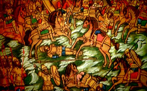
All the Byzantine traders either went bankrupt or became dependent upon foreigners. When the country finally realized what was happening, it was too late. The “Golden Bulla” was annulled, and Emperor Andronikos tried to reverse the flow of money back towards his empire. He confiscated all foreign commercial enterprises, which were draining the government of its last resources. Both he and the country paid dearly for this. He himself was brutally murdered; as for his country… The republic of Venice, which had by that time become a huge financial oligarchy, hired a whole crusade, and sent it to sack Constantinople instead of Jerusalem. The Byzantines, who had up until then considered the crusaders to be in general brothers in the faith and military allies, were so unprepared for such an underhanded blow that it was unable to organize sufficient defense. In 1204, French, German, and Italian contingents of the Western union advanced upon Constantinople and took it over. The city was mercilessly pillaged and put to the torch.
 |
|
At the same time Venice, considered then to be the stronghold of free enterprise, announced to the whole Western world that it was only restoring disdained law and order and the rights of a free international market; and mainly, it was warring with a regime which denies all European values. This was the moment when the West began to create an image of Byzantium as a heretical “evil empire.” As time went by, this image would continually be pulled out for use from Western ideological arsenals. Although Constantinople was recovered sixty years later, Byzantium would never recover from the blow. Meanwhile, foreign traders would retain complete control over both the economy and the Byzantine market.
Another unresolved problem in Byzantium was corruption and oligarchy. The government warred with them continually, and was for a long time was effective. Bureaucrats and financial schemers who had gone too far were punished and exiled, their possessions completely confiscated and given to the treasury. However, the authorities never really had the strength and resolve to sever this evil systematically. Oligarchs gathered entire armies under the pretext of servants and guards, and plunged the government into the thick of civil wars.
 |
|
How did these oligarchs emerge in Byzantium, and why did they become uncontrollable? Byzantium had always been a strictly centralized bureaucratic government; however, this was by no means its weakness, but rather its historical strength. All efforts to combine authority with personal interests were cut off firmly and decisively. However, during one moment in the period of political and administrative reforms, the temptation arose to exchange the old and seemingly awkward bureaucratic machinery for something more effective and flexible, in which the government’s role would be limited, and relegated to that of an overseer of formal legalities. To put it simply, the government, out of good intentions and with its eye upon European experience, in fact willingly relinquished a portion of its strategic monopolistic functions, handing them over to small circle of families. However, contrary to the government’s expectations, this new aristocracy it was feeding did not remain long under the control of the bureaucratic apparatus. Resistance continued with alternating success, and ended in a serious political crisis, out of which the government could escape only at the price of irreversible concessions to foreigners. We know what happened after this. The oligarchic corruption of the government continued up until the very takeover of Constantinople by the Turks.
Incidentally, the oligarchs not only failed to provide the government with money or arms during this final invasion by the Turks, but even grabbed what little was left in the treasury. When the young Sultan Mehmed met took the city, he was shocked at the exorbitant wealth of some citizens while the city’s army was completely lacking. He summoned the richest citizens and asked them a simple question: why they did not provide any money for the city’s protection from the enemy? “We were saving these funds for your Sultanic Majesty,” was their flattering answer. Mehmed had them punished immediately in the cruelest manner: their heads were chopped off, and their bodies thrown to the dogs. Those oligarchs who fled to the West hoping to hide their capital were mercilessly fleeced by their Western “friends,” and ended their lives in poverty.
A huge problem of the Byzantine government during the period of decline was its frequent change in political direction, which could be called a lack of stability and succession in governmental powers. With each change of emperors, the empire’s direction would often change drastically. This weakened the country severely, and cruelly exhausted the population.
Political stability is one of the most important conditions for a strong state. This was the testament of the great Byzantine emperors. However, they began to disregard this testament. There was a period when a new emperor was in power every four years on the average. Could it have been possible under such conditions for the country to undergo a revival, or complete any large-scale state projects—projects which would have required many years of systematic effort?
 |
|
Of course, there were also very strong emperors in Byzantium. One example was Basil II, who was, by the way, Grand Prince Vladimir’s godfather. He took on the Empire’s rule after a serious crisis: the country had been practically privatized by oligarchs. First of all, he took tough measures to enforce a vertical power structure, quelled all separatist movements in outlying territories, and suppressed rebellious governors and oligarchs, who were preparing to dismember the empire. Then he “purged” the government, and confiscated huge sums of stolen money. Basil II’s strict measures allowed him to build the state treasury to unprecedented sums—the Empire’s annual income was ninety tons of gold during his reign. As a comparison, Russia reached such levels only towards the beginning of the 19
th century.
Basil significantly weakened the mighty regional oligarch-magnates. These local sovereigns’ influence and power were at times incomparably greater than that of the official governors. Once, during a military campaign, the Asia Minor magnate Eustaphios Maleinos demonstratively invited Emperor Basil and his troops to rest at his estate, and was easily able to accommodate this huge army until they had sufficiently recuperated. This oligarch seriously hoped to influence the country’s fate. He began his intrigues, then moved his own puppet candidate forward to the upper levels of authority. Later he would pay dearly for this. All of his vast property was confiscated, and he himself was sent to one of the most distant prisons in the Empire.
After the rebellion of another magnate, Bardos Skleros, was put down, Skleros even advised Basil II in a candid discussion to exhaust the magnates with taxes, special tasks, and governmental service, so that they would not have time to get so rich and powerful.
Having restored the structure of authority in the country, Basil left a sort of “stabilization fund” to his successor which was so large, that, in the words of Michael Psellos, he had to dig new labyrinths in the underground treasury stores. This national reserve was designated first of all for military reforms and the organization of a professional, capable army. Basil’s successors, however, ineptly squandered this reserve.
 |
|
Byzantium in general had quite a problem with her “successors,” although the Byzantines were the greatest specialists in the world in the area of royal succession. They did not have the principle of inheritance to the throne. Wishing to ensure that power succeed to a worthy heir, the emperors usually chose one or two candidates, and actively drew them into governmental affairs, delegated high and responsible positions in the government to them, and observed them. There was even a system whereby the country would have at one time an emperor and so-called junior emperors, the heirs. This was all very reasonable, but no matter how well they honed this system of succession, in the final analysis it became clear that it was simply the luck of the draw. Basil II was unlucky. Too occupied with governmental affairs, he was unable to prepare a worthy successor, and the throne passed to his natural brother Constantine VIII. When the new emperor began to feel free, powerful, and fabulously wealthy, he dedicated himself not to governmental affairs, but rather to ecstatic daydreams about accomplishments and glory which were supposed to eclipse those of his brother. The results were sorrowful: under the aegis of the dreamer in porphyry, the cynical ruling elite quickly lost the obedience and discipline cultivated by Basil II, and immersed themselves in power struggles with renewed vigor.
Although the oligarchs quickly achieved their aim, it came with a price. If Basil II punished insubordination by confiscation of property, or, in extreme cases, by blinding (a punishment not uncommon during the Middle Ages), his successor, the hysterical Constantine, during fits of anger, castrated half of his contemporary Byzantine administrative elite. Furthermore, his extravagance eclipsed even that of one of the most dissolute emperors of the country’s period of decline, whose nickname was “The Drunkard,” and like him, in a state of inebriation, entertained the rabble at the city hippodrome, three times larger than this Roman Coliseum.
The next successor also failed to fulfill expectations. The vertical, central power structure began to collapse. The result of a new uprising amongst the clans and elite and the continual re-shifting of property was predictably deplorable—within fifty years the Empire found itself on the brink of destruction.
 |
|
The large stabilizing fund, in the hands of inept sovereigns, caused more harm than good—this money gained without effort began to work against the country by corrupting society. The same historian, Michael Psellos, remarked bitterly that the empire “grew sick” from the misuse and plunder of this money set aside by Basil. “The government’s body,” he wrote, “became bloated. Some were glutted with money; others were stuffed to the gills with ranks, and their lifestyle became unhealthy and destructive. Thus, succession of power was a matter of life and death for the Empire. When there is stability in succession and development, the country has a future; without stability—collapse. But the people did not fully understand this, and kept demanding various changes. Opportunists and run-away oligarchs also played on these popular moods. They would usually hide somewhere abroad and support various intrigues with the aim of overthrowing this or that emperor who did not suit them, providing for their own man and new re-assignments of property. Such an individual was a certain Bessarion, a mediocre scholar, unprincipled politician, and ingenious intriguer of the 15
th century, who fled Byzantium for Rome and received there political asylum. Bessarion coordinated the entire opposition in Constantinople and caused no small headache to the government. He went on further to become a Catholic cardinal. He bought himself a house in Rome. After his death, his Western protectors even named a small street on the edge of town after him.
 |
|
Another serious and incurable disease never before a problem in Byzantium also developed: the question of nationality. The fact of the matter is that nationality problems in Byzantium really had not existed for many centuries. As the historical, lawful descendants of ancient Rome, which was destroyed by barbarians in the fifth century, the inhabitants of Byzantium called themselves Romans. In a vast empire divided into many nationalities there was one faith—Orthodox Christianity. The Byzantines literally fulfilled the Christian teaching of a new humanity living in a Divine spirit, where “there is neither Greek, nor Jew, nor Scythe,” as the Apostle Paul wrote. This hope preserved the country from the destructive storm of ethnic conflict. It was enough for any pagan or foreigner to accept the Orthodox Faith, and confirm it in deed, in order to become a full member of society. On the Byzantine throne, for example, were almost as many Armenians as there were Greeks; there were also citizens of Syrian, Arabian, Slavic, and Germanic origin. Amongst the higher ranks of government were representatives of all peoples in the Empire—the main requirements were their competence and dedication to the Orthodox Faith. This provided Byzantine civilization with incomparable cultural wealth.
The only foreign elements for the Byzantines were people who were strange to Orthodox morals and to the ancient Byzantine culture and perception of the world. For example, coarse, ignorant, money-grubbing Western Europeans of the time were considered barbarian by the Romans. Emperor Constantine VII, “The Purple-born,” instructed his son when choosing a bride, “Inasmuch as every nation has its own traditions, laws, and customs, one should unite in matrimony only with one from amongst his own people.”
In order to understand the emperor’s thoughts correctly, we must recall that his great grandfather was a Scandinavian by the name of Inger, his grandfather was the son of an Armenian man and Slavic woman from Macedonia, his wife was the daughter of an Armenian man and a Greek woman, and his daughter-in-law was the daughter of an Italian king. His granddaughter, Anna, became the wife of the Russian Prince Vladimir, just after the latter was baptized.
 |
|
The very idea of a “nation” was actually a European concept which later in Byzantium evolved into an idea of their own national superiority (or more precisely, of that of the Greeks, around whom Byzantium had grown). Europeans lived in smaller states built upon ethnic principles; for example, France, Germanic countries, and Italian republics. National custom was good and correct for them; but the fact of the matter was that Byzantium was not an ethnic state, but rather a multinational empire, and this was an essential difference. For one hundred years the Byzantines warred with this temptation and did not allow themselves to be broken. “We are all Romans—Orthodox citizens of the New Rome,” they proclaimed. It must be noted that this all unfolded at the very beginning of the epoch called by historians the “Renaissance”—the world-wide creation of a nationalistic, Hellenic-Greek, pagan ideal. It was understandably difficult for the Greeks not to be tempted by this Western European renaissance, and the European fascination with the culture of their great, ancient Greek ancestors.
The first to give in were the intelligentsia. The enlightened Byzantines began to sense their Greekness. Nationalistic movements began, then the denial of Christian traditions, and finally, during the reign of the Paleologi, the imperial ideal gave way to a narrow, ethnically Greek nationalism. However this betrayal of the imperial ideal was costly—the nationalistic fever tore the empire apart, and it was then quickly swallowed up by the neighboring Moslem empire.
One apologist for Hellenic nationalism, the liberal scholar Plethon, arrogantly wrote to Emperor Manuel II, “We, the people whom you command and govern, are Greeks by descent, as our language and educational heritage testify!” Such words would have been unthinkable even a century earlier. However, Plethon wrote them on the eve of the fall of Constantinople, in which were living people no longer Roman, but rather Greeks, Armenians, Slavs, Arabs, and Italians, in enmity with one another.
Greek arrogance led to the discrediting of Slavs in the Empire. Byzantium thereby estranged the Serbs and Bulgarians, who could have provided real help in the struggle with the Turks. The result was that the peoples of the once united Byzantium began to be at enmity with one another.
 |
|
The West did not miss the chance to take advantage of this new problem: it began to forcefully convince the Serbs and Bulgarians that the Greeks have been suppressing their national identity for centuries. Several real revolutions were provoked, and finally, with the help of economic and military forces, the West insisted upon the Serbs’ and Bulgarians’ separation from Byzantium and unification with Latin Europe. These nationalities took the bait, exclaiming suddenly, “We are also Europeans!” The West promised them material and military aide, but of course, deceived them, instead throwing them cynically before themselves as a buffer along the warpath of the Turkish hordes. The Balkan states, so loyal to the West, found themselves under the cruel Turkish yoke for many long centuries. And Byzantium was no longer able to help. National arrogance thus played a wicked role for the empire. Another great problem was the gradual loss of control over the far-flung provinces. The contrast between the provinces and the satiated, wealthy capital, Constantinople, which lived for the most part at the expense of these impoverished areas, became very sharp. At the beginning of the thirteenth century, the Byzantine writer Micheal Choniates wrote to the capital’s inhabitants in bitter reproach, “Do not all riches flow into the city as rivers into the sea? But you do not wish to take a look at the towns around you, who await some fairness from you. You send them one tax collector after another with brutish teeth, in order to devour their last morsels. You yourselves remain in your city to enjoy your peace, and extract the riches.”
Even the capital city’s chief administrator, the eparch of Constantinople, enjoyed a particular status in the country, and his contemporaries often compared his power with that of the Emperor, “only without the purple,” as they would say. One such eparch once became so feverishly involved in the building of high-rise buildings in the capital that he could only be stopped by a special imperial order forbidding the construction of buildings over ten stories.
All political, cultural and social life essentially took place in Constantinople. The government did not wish to notice that a serious imbalance was developing, and the forsaken provinces were becoming more and more decayed. Gradually, the tendency to flee to the center became increasingly marked.
 |
|
Governors of these distant territories also played their deceitful games. Money budgeted and sent to the provinces was shamelessly expropriated. It would not have been half so bad if this stolen money had gone only towards the enrichment of governors and their proteges. But the money was often used to create real armies under the guise of peace officers. These battalions were often more capable in battle than the regular army. When the government weakened, the provinces separated. The government watched this process unfold almost helplessly. But the rebellious governors, having freed themselves of central authority, were not long to remain captivated by their own high hopes. Together with their hapless population, they almost immediately fell prey to the cruel authority of the non-Orthodox. When this happened, the local population was usually destroyed completely, and the region re-settled by Turks and Persians.
The demographic problem was one of the most serious problems in Byzantium. The Empire was gradually inhabited by peoples of a foreign spirit, who firmly supplanted the native Orthodox population. The country’s ethnic composition changed visibly. This was in some ways an irreversible process, for the birth rate in Byzantium was decreasing. But this was not the worst thing. Something similar had earlier occurred periodically. The catastrophe was that the peoples who were pouring into the Empire were no longer becoming Romans, as they once had done, but remained permanently foreign, aggressive, and enemy. Now the newcomers treated Byzantium not as their new homeland, but only as potential property which should sooner or latter come into their own hands.
 |
|
This happened also because the Empire refused to educate the people—a concession it had made to the new, renaissance-era demagogy declaring state ideology to be a violation of the individual. However, nature abhors a vacuum. Having voluntarily renounced their thousand-year ideological function of educating and cultivating the people, the Byzantines made way for influences upon the minds and souls of their citizens; influences which were not so much a promotion of independent and free thinking as they were a form of intentional ideological aggression, aimed at destroying the foundations of state and society. But the Byzantines had amazing, incomparable experience! The best leaders of the Empire were capable of using their vast inheritance—a wealth of experience in governance and subordination. As a result of this acumen, cruel barbarians, after partaking of the great Christian culture, became the most reliable allies, received grandiose titles and vast estates, were numbered amongst the highest ranks of government service, and fought for the interests of the Empire in the furthest stretches of its territory.
As for demographic issues, and the eternal headache of any empire—separatism in the outlying areas—the best Byzantine Emperors left as an inheritance proven methods of solving these issues; for example, creating conditions for the massive resettlement of the inhabitants of centralized areas to the outlying provinces. This would quickly spark an explosion in the birth rate, and effectuate an extraordinary adaptability to the new locality in the second generation.
However, this wealth of experience was cruelly mocked and criminally disregarded in favor of foreign opinion; and, finally, it was irretrievably lost!
But just what was this invasive opinion? Whose views did the Byzantines begin to value? Who was able to so influence their minds that they began to commit such suicidal mistakes, one after another? It is hard to believe that such enormous reverence and dependence could have developed with regard to that same once barbaric West, which had for centuries so enviously and greedily looked upon Byzantium’s wealth, and then coldly and systematically grew fat upon its gradual dissolution.
 |
|
Byzantium was a unique state which differed from both the East and the West. Everyone recognized this fact; some were exhilarated by it, others hated this independence, while others felt oppressed by it. Be this as it may, Byzantium’s difference from the rest of world was an objective reality. First of all, Byzantium was the only country in the world which stretched over a huge territory between Europe and Asia, and its geography was already a large contributing factor to its uniqueness. It is also a very important fact that Byzantium was a multi-national empire by nature, in which the people felt the state to be one of their highest personal treasures. This was entirely incomprehensible to the Western world, where individualism and personal self-will had already been raised to the status of sacred principle. Byzantium’s soul, and its meaning of existence, was Orthodoxy—the unspoiled confession of Christianity, in which no dogmas had changed essentially for a thousand years. The West simply could not endure such demonstrative conservatism, called it non-dynamic, obtuse, and limited; it finally began with grim fanaticism to demand that Byzantium modernize her whole life in the Western image—first of all in the religious, spiritual spheres, and then in intellectual and material spheres. With respect to the uniqueness and particularity of Byzantium, the West, despite its occasional raptures over Byzantine civilization, pronounced the sentence: it must all be destroyed; if necessary, together with Byzantium and her spiritual inheritors.
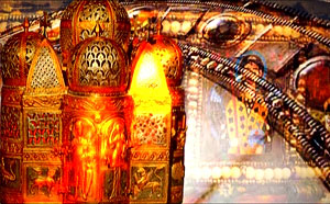
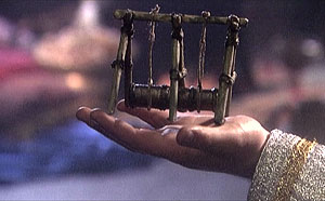
Not a bad organ. Also invented and created in Byzantium. In the ninth century it was brought here to Western Europe, and from that time on, as you see, it has taken root.
Of course, it is senseless to say that the West was to blame for Byzantium’s misfortunes and fall. The West was only pursuing its own interests, which is quite natural. Byzantium’s historical blows occurred when the Byzantines themselves betrayed their own principles upon which their empire was established. These great principles were simple, and known to every Byzantine from childhood: faithfulness to God, to His eternal laws preserved in the Orthodox Church, and fearless reliance upon their own internal traditions and strengths.
For hundreds of years, Byzantine emperors both wise and not so wise, successful governors and inept commanders, saints on the throne and bloody tyrants, when faced with a fateful choice, knew that by following these two rules they ensure their Empire’s ability to survive. In the Holy Scriptures, which every Byzantine knew, this is stated very specifically:
I call heaven and earth to witness before you this day: I have offered you life and death, blessing and curse. Choose life, that ye might live, and your descendents also (Deut. 30:19).
In Byzantium, after the end of the 13
th century, two parties emerged—one called for reliance upon the country’s internal strengths—to believe in them unconditionally, and to develop the country’s colossal potential. It was prepared to accept Western European experience discriminately, after a serious test of time, but only in those cases where such changes would not touch the fundamental basics of the people’s faith and state politics. The other party—pro-Western—whose representatives pointed to the indubitable fact that Europe is developing more rapidly and successfully, began to proclaim more and more loudly that Byzantium has historically exhausted itself as a political, cultural, and religious phenomenon, and to demand a root-level re-working of all state institutions in the image of Western European countries.
Representatives of the pro-Western party, secretly, or more often, openly supported by European governments, held an undoubted victory over the imperial traditionalists. Under their guidance, a series of important reforms took place, including those economic, military, political, and finally, ideological and religious. All of these reforms ended in total collapse, and lead to such spiritual and material destruction in the Empire that it remained absolutely defenseless before its Eastern neighbor—the Turkish Sultanate.
 |
|
First of all, the pro-Western party began to re-evaluate its fatherland’s history, culture, and Faith. However, instead of healthy criticism, they offered only destructive self-abnegation. Everything Western was exulted, and everything of their own was held in contempt. Byzantine history was distorted, faith and tradition were mocked, and the army was degraded. The whole of Byzantium began to be painted as a sort of universal monster. The wealthy Byzantine younger generation no longer studied in its own country, but rather left to study abroad. The best minds of Byzantine science emigrated to the West—the state ceased to give them the proper attention. Emperor Theodore II foretold, “Rejected science will become our enemy and will take up arms against us. It will either consign us to destruction, or turn us into barbarians. I write this in a state of gloomy melancholy.” The Emperor’s presentiment did not deceive him. During the final, fatal attack on Constantinople, a brilliant metal-casting scholar, a Hungarian named Urban, offered to create for the Emperor large artillery armaments which could sweep away the Turkish troops. But the treasury was empty, and the rich of Constantinople did not give any money. Not having received payment, the insulted Urban offered his services to Sultan Mehmed. The Sultan seized the opportunity which would give him the capability to destroy the city’s invincible walls. He provided unlimited funds and began the project. Finally, the canons of Urban, the best student of the Byzantine ballistics school, decided the Empire’s fate.
 |
|
Western reforms in the military along Western lines had begun long before this. In Byzantium there had for many centuries existed a proven, although not always effective system called stratiotes—a national regular army with mandatory service from the age of eighteen. With time, the Byzantine army underwent serious changes. An army of the new type required significant capital. The very stabilization fund of Basil II was earmarked precisely for the creation of an effective army. The fund, as we recall, was squandered, while decisions were made to totally re-vamp the army according the image of a Western professional one. At that time, the Byzantine mind was captivated by the image of Western knights, all nailed into suits of armor—the latest achievement of contemporary military industry. “My Byzantines are like clay pots,” one emperor commented contemptuously about his warriors, “but the Western knights are like iron kettles!” To be brief, as a result of the reforms, they took apart their regular army, but never built the professional one. In the final analysis, they took the course of forming a block with the West within the framework of a new military-political union. In practice this meant that during the most critical periods of war they were forced to resort to a professional army, but not of their own—to a mercenary one. What it means to have a mercenary army, how loyal and capable it is, the Byzantines learned by very bitter experience. Attempting to rely on the West’s experience, the state became more and more ineffective. Even so, they stubbornly sought salvation in a new imitation of Western examples.
The final and most devastating blow to Byzantium was the ecclesiastical union with Rome. Formally, this was the submission of the Orthodox Church to the Roman Pope for purely practically reasons. One after another aggressive attack from foreign nations forced the country to make the choice: either to rely on God and their own strengths, or to concede their age-long principles upon which their state was founded, and receive in return military and economic aide from the Latin West. And the choice was made. In 1274, Emperor Michael Paleologus decided upon a root concession to the West. For the first time in history, ambassadors from the Byzantine Emperor were sent to Lyon to accept the supremacy of the Pope of Rome.
 |
|
As it turned out, the advantages the Byzantines received in exchange for their ideological concession were negligible. The pro-Western party’s calculations not only were unjustified, they collapsed. The union with Rome did not continue for long. The Grecophile Pope Leo IV, who had drawn Byzantium into the Union out of better intentions, died soon after the Union was concluded, and his successor turned out to be of a completely different spirit: the interests of the Latin West were first on his list. He demanded that Byzantium change completely, that it re-make itself in the image and likeness of the West. When these changes did not happen, the Pope excommunicated his newly-baked spiritual son, Emperor Michael Paleologus, and called Europe to a new crusade against Byzantium. The Orthodox converts to Catholicism were pronounced bad Catholics. The Byzantines were supposed to get the point that the West needed only complete and unconditional religious and political submission. Not only the Pope was to be recognized as infallible, but the West itself as well. Another terrible loss from betrayal of the Faith was the loss of trust amongst the people in the government. The Byzantines were shocked by the betrayal of their highest value—Orthodoxy. They saw that it is possible for the government to play with the most important thing in life—the truths of the Faith. The meaning of the Byzantines’ existence was lost. This was the final and main blow which destroyed the country. And although by far not all accepted the Union, the people’s spirit was broken. In place of their former thirst for life and energetic resolve to action, there appeared a terrible general apathy and fatigue. The people no longer wanted to live.
This horror has happened during various periods in history, with various peoples, and with entire civilizations. This is how the ancient Hellenic people died out, amongst whom an inexplicable demographic crisis occurred during the first centuries A.D. People did not want to live; they did not want to continue their generation. The rare families that did form often had no children. The children who were born died from a lack of parental care. Abortions became a ubiquitous practice. The darkest occult and Gnostic cults came aggressively to the forefront—cults characterized by hatred for life. Suicide became one of the main causes of death amongst the population. This conscious dying out of a population has been called by science “endogenous psychosis of the I-III centuries”—a mass pathology and loss of meaning for continued existence.
 |
|
Something similar happened in Byzantium after the conclusion of the Union. The crisis in state ideology led to total pessimism. Spiritual and moral decline began to take over, along with unbelief, interest in astrology, and the most primitive superstitions. Alcoholism became a true scourge of the male population. A morbid interest in long-forgotten mysteries of the ancient Greeks arose. An intelligentsia fascinated with neo-paganism consciously and cynically destroyed the foundations of Christian Faith in the people. Processes of depopulation and family crises ensued. Out of the 150 Byzantine intellectuals known to us to have lived during the late 14
th, early 15
th centuries, only twenty-five had families of their own. This is only a small part of what came to Byzantium due to the decision amongst the elite to sacrifice higher ideals for the sake of practical advantages. The soul collapsed; in a great nation, who had given the world grandiose examples of flights of spirit, now reigned unbridled cynicism and squabbles. One Russian pilgrim wrote bitterly during the mid 14
th century, “Greeks are those who have no love.”
The best minds of Byzantium watched with sorrow as the Empire gradually died, but no one heeded their warnings. The high profile statesman, Theodore Metochites, who saw no salvation for Byzantium, wept over the former greatness of the “Romans” and their “perished happiness.” He lamented the Empire “wasted by illnesses, easily succumbing to every attack by its neighbors, and become the helpless victim of fate and eventuality.”
A new Union signed in Florence, in what was now a completely mad hope for help from the West, did not change a thing. For the Byzantines themselves this was a new moral blow of great magnitude. Now, not only the Emperor, but even the Holy Patriarch shared the faith of the Latins. However, despite various hierarchs’ betrayals, the Orthodox Church stood firm. “All were against the Union,” a Byzantine historian relates.
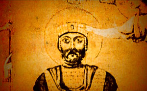
“O, piteous Romans!” monk Gennadios Scholarios wrote prophetically from his seclusion after the signing of the Florentine Union, and fourteen years before the fall of Constantinople. “Why have you gone astray from the right path? You have departed from hope in God and begun to hope in the might of the Franks. Together with the city, in which everything will soon be destroyed, have you apostatized from your piety? Be merciful to me, O Lord! I witness before the face of God that I am not guilty of this. Return, wretched citizens, and think about what you are doing! Together with the captivity which will soon befall us, you have apostatized from your fathers’ inheritance and begun to confess dishonor. Woe to you, when God’s judgment shall come upon you!”
The words of Gennadios Scholarios came true to the letter. And he himself was to carry the unbearably heavy cross of a bitter patriarchate—he became the first Orthodox patriarch in Constantinople after its fall to the Turks.
 |
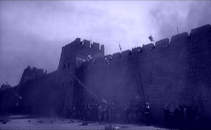
|
The fatal year of 1453 was approaching. In April, Sultan Mehmed, still a very young man of twenty-one, about the age of a college sophomore in todays’ Istanbul, attacked Constantinople. The Sultan was absolutely delirious with the idea of taking the Romans’ capital. His elder councilors-viziers, one of whom was a secret agent from Byzantium, persuaded him to cancel the attack, saying that it was too dangerous to battle on two fronts, for all were certain that battalions from Genoa and Venice would arrive any minute. But the Sultan turned out to be a disobedient pupil. The promised help from Europe, of course, did not arrive. To the party of Westernizers in Constantinople there was also added a pro-Turkish party. Sad as it may be, there was no true Byzantine-imperial party amongst the politicians.
 |
|
The Turkish party was headed by the first minister and admiral, Grand Duke Notaras. He announced for all to hear that “It would be better to see the Turkish chalma cap ruling in the city than the Latin tiara.” A little later he, the first minister, was to fully experience just what this ruling Turkish chalma cap was actually like. When Sultan Mehmed II took the city, amidst the general pillage and wild mayhem, he decided to appoint this very Notaras as head of the city. However, when he learned that the Grand Duke had a fourteen-year-old son of rare beauty, he demanded that the son be first surrendered to his harem of boys. When the shaken Notaras refused, the Sultan commanded that both he and the boy be beheaded. The terrible outcome was unfolding inescapably.
O Heavenly King, Comforter, Spirit of Truth, Who art everywhere present and fillest all things, treasury of good gifts and Giver of life, come and abide in us, and cleanse us of all impurity, and save our souls, O Good One.
Narrator. May 29, 1453, after a siege lasting many months and resisted heroically by the city’s defense forces, the Turks were able to break through the upper wall. The defense forces, frightened, turned to flight. The last Byzantine Emperor, Constantine Paleologus, remained alone, abandoned by all. Holding his sword and shield, the Emperor exclaimed, “Is there not a Christian who might take off my head?” But there was no one to answer. The enemies surrounded him, and after a brief siege, the Turks standing behind the sovereign killed him with a knife in the back.
Modern Istanbul. The streets of the city. The chant of the muezzin.
Narrator: (walking through the city): What more is there to say?... Now a completely different people are living here, with different laws and morals. The Byzantine inheritance, foreign to the invaders, was either destroyed or altered at the root. The descendants of those Greeks who were not destroyed by the conquerors were made into second class citizens in their own land, with no rights, for many long centuries.
A Western advertisement in Istanbul.
The West’s vengeful hatred of Byzantium and her successors is entirely inexplicable to the West itself; it goes to some deep genetic level, and—as paradoxical as this may seem—continues even to the present day. Without an understanding of this amazing but undeniable fact, we risk misunderstanding not only distant history, but event historical events of the twentieth and twenty-first centuries .
In Russia, before the revolution, serious research on Byzantium was conducted. However, the necessary conclusions were not drawn from purely theoretical knowledge…. During the first decades of soviet government, research in Byzantology was cut off, and then officially banned. More than that: just in case, the Bolsheviks repressed all Byzantologists remaining in Russia; only a few were able to flee abroad.
 |
|
Research in Byzantology was re-opened in Russia by a decision from the highest governmental levels. In 1943, at Stalin’s orders, the Institute of Byzantology was created, and a corresponding cathedra in the Moscow State University was opened. Was there no other time than 1943 to open such an institute? It is simply that the former seminarian, Joseph Dzhugashvili, finally understood from whom they should be studying history. And the great city of Constantinople, which had oft times forgotten the ancient laws of its fathers, for which forgetfulness it did not even preserve its own name, performs if only its final service as an instructor, to retell the story of its greatness—and of the monumental fall of a great empire.
The chanting of the muezzin over Constantinople grows louder. The sound of a Russian snowstorm blends into it.
We are again before a snow-covered Russian church. With it in the background is heard the prolonged chanting of the muezzin and the snowstorm. The chanting gradually disappears. The snowstorm.